
Turn left here. (Bøveien/Brennaveien). Photo: Bjørn Opdahl

The car park at Brenna. Photo: Bjørn Opdahl

The path to Lynghaugtinden passes this rock. Photo: Bjørn Opdahl

Just after the path junction you see Lynghaugtinden. Photo: Bjørn Opdahl
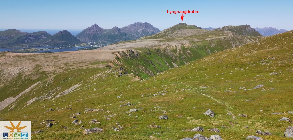
Lynghaugtinden seen from the top of Vetten. Photo: Bjørn Opdahl

The path is marked where it is needed. Photo: Bjørn Opdahl

The last part towards the top. Photo: Bjørn Opdahl

Words of wisdom at the top. Photo: Bjørn Opdahl

View to the east from the top. Photo: Bjørn Opdahl

View to the north. Photo: Bjørn Opdahl

View to the west. Photo: Bjørn Opdahl

View towards Bøvetten in the south. Photo: Bjørn Opdahl

Here the path goes under the Bøvetten on the return trip. Photo: Bjørn Opdahl
Lynghaugtinden (TVB5)
Text: Bjørn Opdahl
Starting Point
The tour starts from the car park at Brenna. (see pictures)
Directions
Follow road 820 (Bøveien) eastwards from Bø/Vinje towards Steine. (see map) At Steine, turn left onto Brennaveien. (see pictures) After about 40 metres, Brennaveien turns to the right. It is approximately 700 meters from the Bøveien/Brennaveien junction to the car park.
Tour description
At the start, you follow the old church road to Bø church. Then you follow a clear path/forest road up to Losjehytta, and on towards Bøvetten/Vetten.
From Losjehytta there is a gently rising terrain up to the place where the path to Lynghaugtinden takes off from the path to Vetten. From there and towards Lynghaugtinden, it goes up a bit and down a bit. The last part up to the top of Lynghaugstinden is somewhat steep, but easy to walk.
Highlights of the trip
The trip goes over a mountain section on an island that is otherwise small and mostly quite flat. This means that you have an incredibly beautiful view during the entire trip.
Losjehytta is a natural place to take a short break. It is also nice to go up to Bøvetten-bua, which is located on the edge of Bøvetten /Vetten, and enjoy the view from there. The view from the top of Lynghaugtinden should only be experienced. (see video)
Difficulty and time use
The trip is considered a relatively difficult trip. This is mainly due to the length of the trip, which is 14 km in total round trip. It is about 490 meters in height from the car park to the top of Lynghaugtinden. When you are at the Losjehytta (1.5 km) you have walked approx. half of the height meters. Based on this, it should take approx. 3.5 - 4 hours to walk the whole trip.
The terrain is clear and easy to walk in, and the paths are good and very clear. The only place where it can be a little difficult to find the right path is where the path to Lynghaugtinden takes off from the path up to Vetten. (see picture)
If you are a bit fit, there is no problem to go first to the top of Bøvetten, and then on to Lynghaugtinden. On the return journey, you do not need to visit the top of Bøvetten. The path to and from Lynghaugtinden goes under the top of Bøvetten.
Vodcast: Lynghaugtinden(87 MB)